


Trainsity Kuala Lumpur LRT KTM
Perihal Trainsity Kuala Lumpur LRT KTM
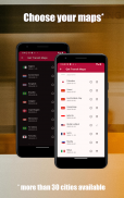
Navigasi rangkaian kereta api awam global Kuala Lumpur dan lain-lain dengan mudah menggunakan peta vektor resolusi tinggi aplikasi kami. Pilih dan muat turun peta yang anda perlukan, menikmati tahap zum terperinci tanpa mengorbankan ruang storan. Lihat jadual dan kekerapan laluan kereta api, dan stesen perlepasan pertama/terakhir (untuk peta dengan jadual). Akses semua ciri di luar talian, tanpa memerlukan sambungan internet.
Temui cara yang lancar untuk meneroka rangkaian kereta api dengan aplikasi intuitif dan cekap kami.
Peta tersedia pada masa ini untuk:
- Singapura
- Kuala Lumpur, Malaysia
- Sapporo, Jepun
- Recife, Brazil
- Brasilia, Brazil
- Vancouver, Kanada
- Hong Kong, China
- Bangkok, Thailand
- Manila, Filipina
- Osaka, Jepun
- Amsterdam, Belanda
- Hanoi, Vietnam
- Utrecht, Belanda
- Jakarta, Indonesia
- Rio de Janeiro, Brazil
- Palembang, Indonesia
- Edmonton, Kanada
- Calgary, Kanada
- Sydney, Australia
- Fukuoka, Jepun
- Paris, Perancis
- Fortaleza, Brazil
- Montreal, Kanada,
- Rom, Itali
- Toronto, Kanada
- Lyon, Perancis
- Algiers, Algeria
- Sao Paulo, Brazil
- Perth, Australia
- Bandar Ho Chi Minh, Vietnam
- Milan, Itali,
- Nuremberg, Jerman,
- Copenhagen, Denmark,
- Sobral, Brazil
- Natal, Brazil
Bahasa yang disokong oleh Apl:
Inggeris, Melayu, Indonesia, Cina, Portugis, Jepun, Tamil, Thai, Sepanyol, Belanda, Vietnam, Perancis, Itali, Arab, Jerman, Denmark
Trainsity Kuala Lumpur LRT KTM - Versi 3.6.3
(21-05-2025)Trainsity Kuala Lumpur LRT KTM - Maklumat APK
Versi APK: 3.6.3Pakej: com.dom925.trainsity.kualalumpurVersi Terkini Trainsity Kuala Lumpur LRT KTM
Versi lain


Aplikasi dalam kategori sama


Anda juga mungkin suka...


